Highlights
- Hurricane Milton intensifies to Category 5 with 160 mph winds.
- Tampa Bay region prepares for storm surges of 8-12 feet.
- Heavy rainfall expected across Florida, raising flooding concerns.
- Milton is the second Category 5 hurricane of 2024, following Beryl.
- Experts debate the need for a Category 6 rating due to stronger storms.
- Florida officials urge residents to evacuate and prepare for Milton.
- Rapid intensification of storms linked to climate change and warmer waters.
- Milton could join a rare list of U.S. Category 5 landfalls.
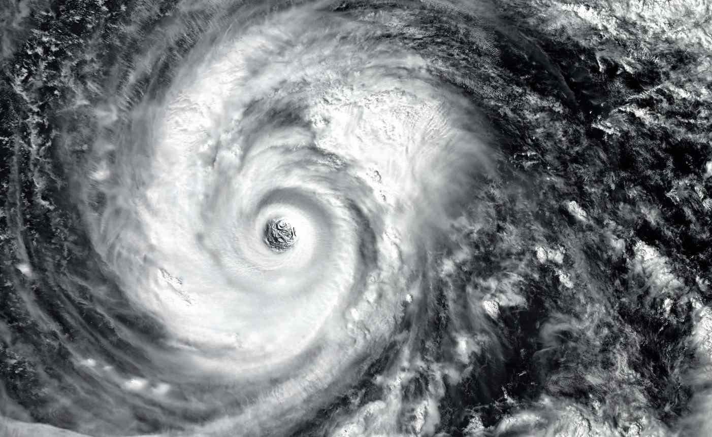
Hurricane Milton has rapidly intensified into a fierce Category 5 storm with sustained winds of 160 mph.
This storm is set to cause significant damage as it moves toward Florida’s Gulf Coast, making it the second Category 5 hurricane this season, after Beryl.
Florida officials have urged residents to prepare for the worst, especially as the storm is expected to hit the Tampa Bay region, which is home to over a million residents.
Milton, which strengthened by a staggering 95 mph in just 24 hours, is now expected to bring storm surges of 8 to 12 feet in Tampa Bay.
Heavy rainfall of 5 to 10 inches will also spread across mainland Florida and the Keys, raising alarms over severe flooding and potential destruction.
Category 5 Hurricanes
Category 5 hurricanes are the most extreme storms in the Atlantic Basin, requiring sustained winds of at least 157 mph to earn the designation.
Before Milton and Beryl, there had only been 40 such hurricanes since 1924. These monstrous storms are incredibly rare, and it’s even less common for two Category 5 storms to occur in the same season.
Meteorologists have noted that such storms typically form in areas with warm, deep ocean waters, which fuel the hurricane’s growth.
The Gulf of Mexico, known for its warm waters, has become a hotspot for such intensifications. Dr. Phil Klotzbach, a tropical scientist, pointed out that Milton is only the second Gulf of Mexico hurricane to reach Category 5 in October since 1966, following in the footsteps of Hurricane Michael in 2018.
Florida on High Alert as Milton Approaches
The Tampa, St. Petersburg, and Clearwater areas, which are densely populated, are expected to bear the brunt of the storm when it makes landfall on Wednesday, October 9. Florida Governor and local authorities have urged people to complete their storm preparations and follow evacuation orders.
Sheriff Chad Chronister of Hillsborough County, which includes Tampa, warned citizens, “Don’t gamble your lives,” while noting that the region is still recovering from the devastation caused by Hurricane Helene, a Category 4 storm that hit just days earlier.
Emergency management is now preparing for one of the largest evacuations Florida has seen since 2017.
Hurricane Milton and the Debate on Category 6 Storms
Some meteorologists and weather enthusiasts have questioned whether it might be time to introduce a Category 6 classification to account for the increasingly powerful hurricanes driven by climate change.
While the Saffir-Simpson Hurricane Wind Scale currently only goes up to Category 5, some experts argue that modern hurricanes, like Milton, are pushing the boundaries.
“Yesterday, Milton was expected to be a Category 3 storm, and now it’s a Category 5. Could this be the storm that breaks the 192 mph barrier and becomes a Category 6?” one user on X speculated.
Although no official plan is in place to introduce a Category 6, scientists like climatologist Michael Mann have discussed the possibility.
He explained that a new category might better reflect the reality of storms with wind speeds exceeding 200 mph, which could become more frequent due to climate change.
Former NOAA Hurricane Hunter Jeff Masters also commented on this, saying that it would make sense from both a scientific and climate change communication perspective to expand the Saffir-Simpson scale to account for these “ultra-intense catastrophic hurricanes.”
Florida’s Storm History and Rapid Intensification of Hurricanes
Milton’s rapid intensification—strengthening by 95 mph in just 24 hours—has become a concerning trend in recent years.
This phenomenon has been linked to the unusually warm waters of the Atlantic and the Gulf of Mexico.
Warmer ocean temperatures provide hurricanes with the energy needed to strengthen quickly.
This is the second time in 2024 that a Category 5 storm has formed in the Atlantic Basin.
Earlier in July, Hurricane Beryl became the earliest Category 5 on record, shattering a record set by Hurricane Emily in 2005 by more than two weeks.
Historically, most Category 5 storms have occurred in September, the peak of the Atlantic hurricane season.
However, recent trends show that these dangerous storms are forming earlier and later in the season, as seen with Milton in October and Beryl in July.
How Category 5 Hurricanes Impact the U.S.
Despite their intensity, Category 5 hurricanes rarely make landfall in the mainland U.S. To date, only four hurricanes—Michael in 2018, Andrew in 1992, Camille in 1969, and the 1935 Labor Day hurricane—have struck the U.S. with Category 5 strength.
Hurricane Ian came close in 2022, but it weakened slightly to a Category 4 just before making landfall.
Hurricane Milton is on track to become the next storm to potentially make history, and officials are urging residents to take the threat seriously.
